Home » ᐛᓇᑲᑐᐛᐃᑕᑲᓄᒋ ᐊᔅᒋᔭ » Tursujuq-Nord
Tursujuq-Nord
TERRITORIAL RESERVE FOR PROTECTED AREA PURPOSES
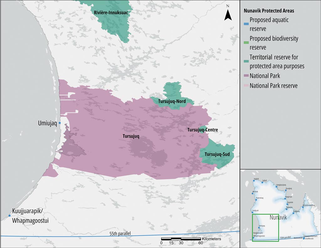
The Tursujuq-Nord territorial reserve for protected area purposes (Réserve de territoire aux fins d’aire protégée de Tursujuq-Nord) further protects Tursujuq National Park by enhancing the protection of critical harbour seal habitat in Lacs des Loups Marins. It also protects the entire Nastapoka River watershed. This territory is also within the range of the Leaf River migratory caribou herd. The reserve also contributes to the protection of Cree cultural and historical sites (including some key wildlife areas, historic travel routes, sacred sites, burial grounds, etc.).
")
ᐊᑎᓇᑕᐃᑲᓄᒡ ᐃᔨᒧᐅᓐ
Land Category – JBNQA and NEQA
Category III
Main conservation objectives
To protect critical harbour seal habitat in Lacs des Loups Marins and the Nastapoka River watershed.
Geological province
Minto Sub-province (Superior Province)
Natural regions
Lac Nedlouc Plateau, Nastapoka Plateau, Lac D’Iberville Hills
Bioclimatic domain
Forest tundra, (Low Arctic Ecozone)
Wildlife
Harbour seal of Lacs des Loups Marins, Leaf River migratory caribou herd
Hydrology
Nastapoka River watershed
Archaeological sites
No sites listed in the inventory of archeological sites of Quebec (Inventaire des sites archéologiques du Québec (ISAQ)).
 © Marianne Ricard, KRG/ARK")