Home » ᐛᓇᑲᑐᐛᐃᑕᑲᓄᒋ ᐊᔅᒋᔭ » Rivière-Kovik
Rivière-Kovik
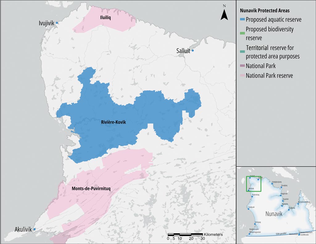
PROPOSED AQUATIC RESERVE
The Kovik River is an important place for traditional and subsistence activities such as Arctic char fishing, mainly practised by members of the Inuit communities of Puvirnituq, Akulivik, Ivujivik and Salluit. This activity is also carried out with the aim of ensuring food security and sovereignty. The river has been identified as a priority area for conservation based on cultural and ecological considerations. Numerous archaeological sites have been listed there.
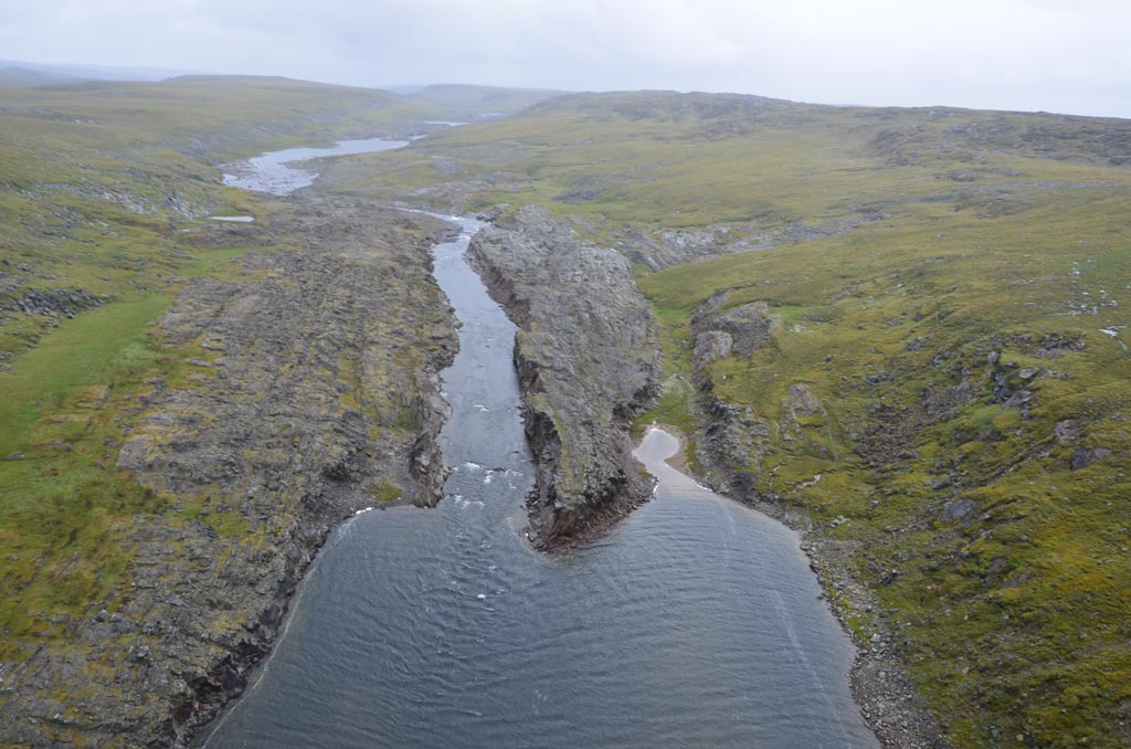
 © Catherine Pinard, KRG/ARK")
Specifically, in 2015, the Avataq Cultural Institute conducted a field study to identify archaeological sites in the vicinity of Kuuvik Bay in collaboration with the KRG, the Centre d’études nordiques (CEN), the Northern Village of Akulivik, and the Qekeirriaq Landholding Corporation of Akulivik.
Establishing the boundaries of the Rivière-Kovik proposed aquatic reserve (Réserve aquatique projetée de la Rivière-Kovik) proved to be a significant challenge due to the definition of Quebec’s coastal and offshore boundaries in Nunavik, which differed according to different organizations and applicable land claim agreements. A compromise between the Government of Quebec and the Makivik Corporation was finally reached on the western outer boundary of the Rivière-Kovik proposed aquatic reserve (Réserve aquatique projetée de la Rivière-Kovik). This boundary was established further inland, with a buffer radius of 50 metres from the coast.
The conservation plan for the proposed aquatic reserve provides a description of the territory and the type of protection status proposed.
ᐊᑎᓇᑕᐃᑲᓄᒡ ᐃᔨᒧᐅᓐ
Land Category – JBNQA and NEQA
Category II
Main conservation objectives
To protect and maintain the biological diversity and natural and cultural resources associated with the territory, including the protection of the Arctic char.
Geological province
Churchill Province
Natural region
Salluit Plateau
Bioclimatic domains
– Shrub arctic tundra
– Herbaceous arctic tundra
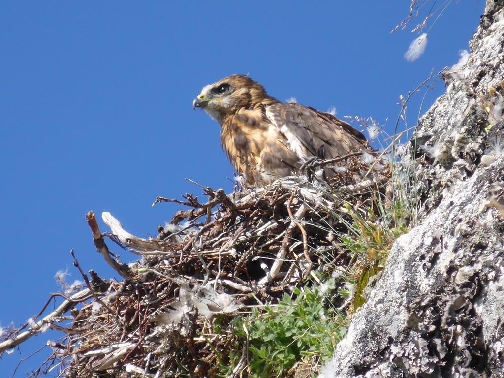
Wildlife
Terrestrial
Migratory caribou (Leaf River herd) – Ungava lemming – Arctic hare – Grey wolf – Polar bear – Arctic fox
Aquatic
Arctic char – Lake cisco – Three-spined stickleback – Ninespine stickleback – Lake whitefish – Lake trout
Avian
Canada goose – Snow bunting – Tundra swan – Common eider – Snowy owl – Rock ptarmigan – Snow goose
Archaeological sites
21 sites listed in the inventory of archeological sites of Quebec (Inventaire des sites archéologiques du Québec (ISAQ)) have been identified inland from Kuuvik Bay and several others have yet to be studied.
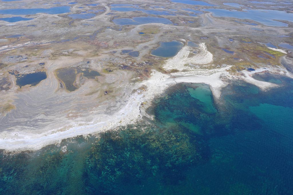
 © Catherine Pinard, KRG/ARK")
Conservation plan:
References:
- Campeau, S., Lavoie, I. & Dubuc, R. (2015). Lake and river diatom communities of the Kovik River Basin. Report for the Kativik Regional Government. Département des sciences de l’environnement, Université du Québec à Trois-Rivières, December 2015, 30 pp.
- Archaeological Survey in Kuuvik Bay, Summer 2015, Avataq Cultural Institute January (2016).