Home » Protected areas » Lac-Jeannin
Lac-Jeannin
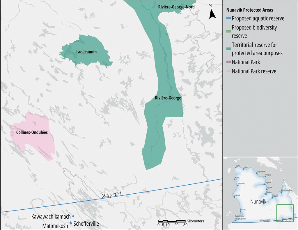
TERRITORIAL RESERVE FOR PROTECTED AREA PURPOSES
The Lac-Jeannin territorial reserve for protected area purposes (Réserve de territoire aux fins d’aire protégée du Lac-Jeannin) is located approximately 166 km north of the Naskapi community of Kawawachikamach, 175 km north of the town of Schefferville and the Innu community of Matimekush-Lac-John, and 205 km southeast of the Inuit village of Kuujjuaq. It is part of the Ungava Bay Basin natural province. The main watercourse in the protected area is the Rivière à la Baleine, which flows into Lac Jeannin and Lac Ninawawe before emptying into Ungava Bay.
")
Characteristics
Land Category – JBNQA and NEQA
Category III
Main conservation objectives
To ensure the protection of representative ecosystems in the Lac Jeannin Depression and Labrador Hills natural regions. Also aims to protect nearly 1,180 water bodies.
Geological province
Sub-province of the Core Zone (Churchill Province)
Natural regions
Lac Jeannin Depression and the De Pas Hills
Bioclimatic domain
Information pending
Wildlife
Not available
Hydrology
Part of the Rivière à la Baleine watershed.
Lac Jeannin is the largest lake in this reserve.
Archaeological sites
No sites listed in the inventory of archeological sites of Quebec (Inventaire des sites archéologiques du Québec (ISAQ)).
 © Catherine Pinard, KRG/ARK")
No MELCC fact sheet available